Climate action group identifies coastal homes in Northumberland at risk
and live on Freeview channel 276
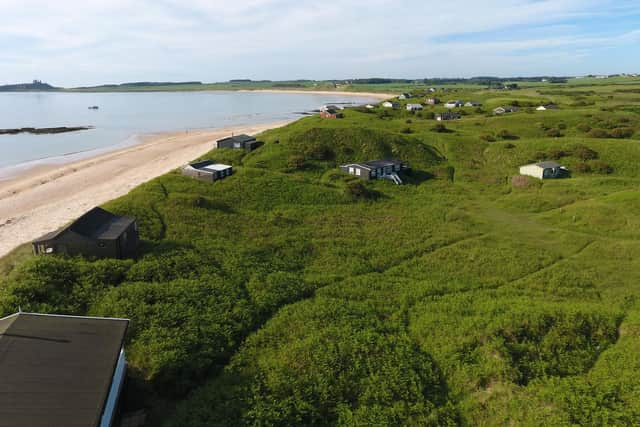
Properties in Chuck Bank, an area between Newton-by-the-Sea and Embleton, are among 21 areas of the UK identified by One Home as being at risk.
It has carried out research which estimates how much coast could be lost by the end of the century assuming that current policies on whether to defend, retreat or abandon sections of coastline are followed.
Advertisement
Hide AdAdvertisement
Hide AdThe group used data from the Environment Agency’s National Coastal Erosion Risk Mapping (NCERM) dataset and compiled a map highlighting what shoreline management plans are in place in different areas of coast, and what the level of protection is.

Nationally, it estimates almost £600 million worth of coastal homes in England could be lost to the sea with Cornwall, Cumbria, Dorset, East Yorkshire, Essex, the Isle of Wight, Kent, Northumberland, Norfolk and Sussex most at risk.
Angela Terry, chief executive of One Home, said: “Sea levels are rising as global temperatures soar and so larger waves batter our coast during severe storms.
“These irreversible changes mean some cliff faces are crumbling fast.
Advertisement
Hide AdAdvertisement
Hide Ad“We can’t turn the tide or build a wall around the entire coast so we urgently need to help seaside communities to prepare for the damage that will come.
“Shoreline management plans are publicly available documents but most people are unaware of their existence.
“Many homeowners don’t know their properties are at risk or that decisions have been made about whether to protect them or not.
“SMPs are not statutory, so new developments can continue.
“Funding is not guaranteed so even where communities have been chosen to be saved, the money might not be there, giving people false hope that their home will be protected long-term.
Advertisement
Hide AdAdvertisement
Hide Ad“One Home’s aim with this map is to explain SMPs in an easy-to-digest way so that homeowners are sufficiently informed to make timely decisions about their properties to reduce future harm.”
More than a third of England’s coastline has a designation of ‘no active intervention’.
The other two levels of protection are ‘hold the line’, meaning defences will be maintained and upgraded if funding is found, and ‘managed realignment’ which involves allowing the shoreline to retreat in a managed way.
To see One Home’s map, visit: https://onehome.org.uk/campaign/campaigns/coast/interactive-map/